Beavers! Investigation of the Geomorphic effects of Beaver reintroduction using High Resolution Topographic surveys
In March, Dr Mark Smith and Dr Megan Klaar returned to Cropton Forest, North Yorkshire to a site in which two beavers (and the later addition of two kits) were released as part of a Forestry Commission reintroduction scheme aimed at restoring natural processes and reducing flood risk in the area.
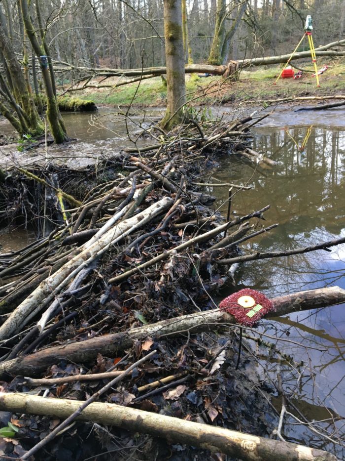
Mark and Megan had previously visited the site in March 2019, just before the beavers were introduced, and carried out a 3D high resolution topographic survey combining both Terrestrial Laser scanning and Structure-from-Motion photogrammetry. This was repeated one year on to quantify the beaver-induced changes to the environment.
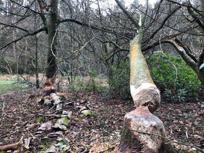
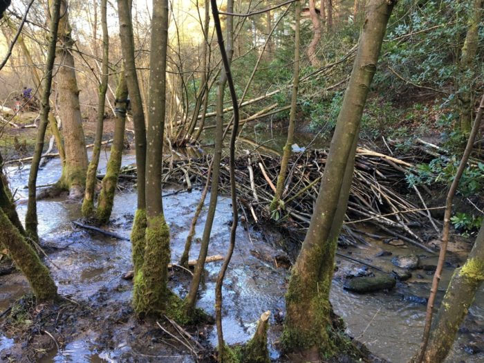
Not quite knowing what to expect on their return, they were amazed at how busy the industrious beavers had been. The beavers had dug a canal to connect two pre-existing ponds and then greatly expanded the pond area by blocking the pond outlets. They also constructed a fresh dam that completely spans the river, and forces it out of the bank and onto the woodland floor (handily, directly in the location that was surveyed pre-beaver). The changes are sure to have an impact on the local hydrology of the site as well as the geomorphology and ecology of the area.
Mark and Megan will carry out an additional survey next year to further determine how the beavers have been interacting with their environment, as well as teaming up with Exeter University who are monitoring the hydrology of the site.